Aerial View of Toronto, Canada
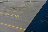
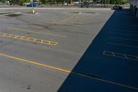
This aerial photo showcases an elevated view of an urban road in Ontario, Canada. The picture captures the cityscape of Toronto, with the asphalt road and driveways clearly visible. The high position of the shot creates hard shadows that accentuate the urban design of the city. This top-down view provides a unique perspective on the city's entryways and road infrastructure. The photo represents a typical day in Ontario, with the sun casting shadows and highlighting the urban landscape.
1 / 3

Buy and Download
File type options
Details
- Asset Type
- Backplate
- Image name
- KEO_061517_S_B07_11508163
- Location
- KEO_061517#S_B
- Dimension
- 9820 x 6550 Pixel
- Available file formats
- JPG , TIF , DNG
Top